2021 30 Day Map Challenge Postmortem

In November, I took part in a 30-day challenge to create a map every day. Here is a compilation of the work that I did and some thoughts on the experience.
What is #30DayMapChallenge?#
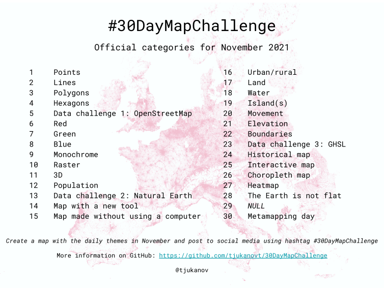
The idea behind the #30DayMapChallenge is to create a map each day in the month of November in response to a different theme per day. There are no restrictions on tools, technology, or data. You can learn more about the challenge at the #30DayMapChallenge home page. Here is an overview of the themes for 2021:
- Points
- Lines
- Polygons
- Hexagons
- Data challenge 1: OpenStreetMap
- Red
- Green
- Blue
- Monochrome
- Raster
- 3D
- Population
- Data challenge 2: Natural Earth
- Map with a new tool
- Map made without using a computer
- Urban/rural
- Land
- Water
- Island(s)
- Movement
- Elevation
- Boundaries
- Data challenge 3: GHSL
- Historical map
- Interactive map
- Choropleth map
- Heatmap
- The Earth is not flat
- NULL
- Metamapping day
Why Did I Participate?#
I set out to learn something new and have some fun. The challenge looked like a good way to practice mapmaking in both 2D and 3D. It also started right after the release of ArcGIS Pro 2.9 so I thought it would be a good opportunity to showcase for the community some of the new features we had worked on for that release. I couldn’t find the time to participate in all 30 days, but I was surprised to see that I created 16 maps by the end of it. Here’s a reel of the maps I created:
What Went Well?#
- I got a lot of new experience during the challenge with a variety of tools.
- Past tools: ArcGIS Pro, Blender
- New tools: Campaign Cartographer 3, Aerialod
- Games: Carcassonne, Isle of Skye, Cities: Skylines, Cartographers
- I helped showcase Animated Symbols, Scene Effects, and Layer Blends in ArcGIS Pro.
- I tried out workflows in ArcGIS Pro that I hadn’t tried before.
- I learned more about GIS and cartography.
- I experimented with new data sources.
- I used Blender geometry nodes to bring in the elevation height map which I think worked a lot better than plain old displacement modifier
- I connected more with the GIS community on Twitter.
- I made 16 new maps!
What Could be Improved?#
- I think it would help to keep a log of interesting data and ideas throughout the year to prep for #30DayMapChallenge. When the challenge started and throughout, I looked ahead at themes for other days to try to plan ahead, but I feel like I spent a lot of time just thinking of interesting maps and searching for data that I could have spent on actually creating.
- I should remember to think about what projections to use for particular maps.
- I’d like to improve my Blender GIS workflows for next time. I’ve mostly only imported elevation maps into Blender and it’d be cool to include other data.
Closing Thoughts#
Overall, it was a really great experience and I’m looking forward to participating again next year. If you have any questions about any of the maps that I made, feel free to reach out to me.